|
|
 |

Click on an image for more details
|
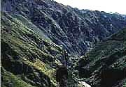
Deeply incised stream and rugged topography on the eastern slope of the souther Peruvian Andes. |
|
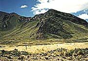
Spectacular angular unconformity attributed to sub-Carboniferous folding, between vertically dipping lower Paleozoic strata (middle ground) and subhorizontally overlying Mesozoic rocks (skyline). Photograph is taken near Tayataya, Puno quadrangle, in the antiplano of souther Peru. |
|
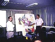
Lecture presentation on geology of parts of Western Canada at offices of INGEMMET, Lima, Peru (see figure caption 4). |
|
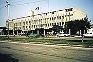
Office of INGEMMET (Instituto Geologico Minero y Metalurgico), the Peruvian Geological Survey, in Lima, Peru. |
|
 |
|