|
|
 |
MAP:GAC constitutes an important advance in horizontal cooperation between the national geologic agencies of the Andean region.
The Project is oriented to study the geologic hazards and land use with the aim of establishing the parameters and rules to help public and private institutions make wiser decisions about geological problems that affect Andean communities. The participant institutions are the Geological Mining and Metallurgical Institute of Peru (INGEMMET) and the national geoscience agencies of Argentina, Bolivia, Chile, Colombia, Ecuador and Venezuela, with the supervision of the Geological Survey of Canada.
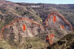
INGEMMET along with the Geological National Direction of Ecuador (DINAGE) is developing the ?Geoenvironmental Study of the Chira-Catamayo River Basin?. This project includes a total area of 17,000 km2, corresponding to 10,017 km2 of Peruvian territory.
Significant advances in project activities include: obtaining bibliographical and cartographic information; digitization of the base map on ArcInfo, scale 1:100,000; coordination with Peruvian and Ecuadorian institutions involved in the management of the river basin; preliminary works for the geological integration of Ecuador and Peru; mapping in the river basin; and beginning of the geological hazards inventory that affects the Peruvian territory in relation to the meteorological phenomena of El Ni?o.
In the present year we will work together with SERGEOMIN of Bolivia on a geoenvironmental study of the Peruvian-Bolivian Altiplano.
|
|
|
 |
|